LEVEL CROSSING RISK ASSESSMENT – SITE VISITS & CENSUSES
Operations Manual Procedure: 5-23
PROTECTEDCROSSING ALCRM USER DATA COLLECTION
Page: 1 of 5
Location
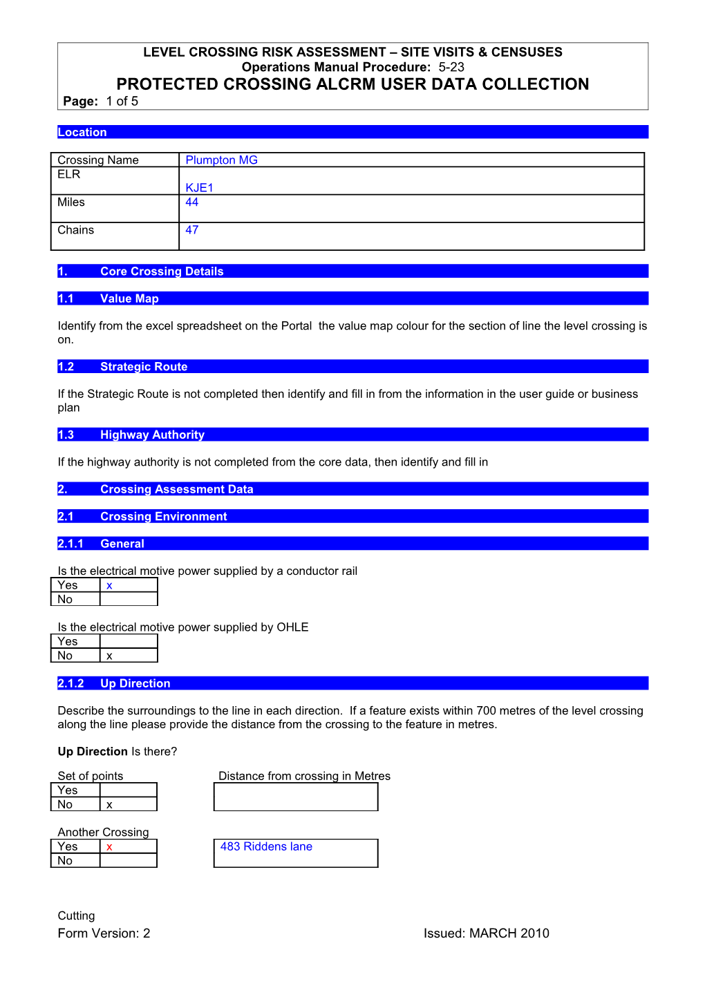
Crossing Name / Plumpton MGELR / KJE1
Miles / 44
Chains / 47
1.Core Crossing Details
1.1Value Map
Identify from the excel spreadsheet on the Portal the value map colour for the section of line the level crossing is on.
1.2Strategic Route
If the Strategic Route is not completed then identify and fill in from the information in the user guide or business plan
1.3Highway Authority
If the highway authority is not completed from the core data, then identify and fill in
2.Crossing Assessment Data
2.1 Crossing Environment
2.1.1General
Is the electrical motive power supplied by a conductor rail
Yes / xNo
Is the electrical motive power supplied by OHLE
YesNo / x
2.1.2Up Direction
Describe the surroundings to the line in each direction. If a feature exists within 700 metres of the level crossing along the line please provide the distance from the crossing to the feature in metres.
Up DirectionIs there?
Set of points Distance from crossing in Metres
YesNo / x
Another Crossing
Yes / x / 483 Riddens laneNo
Cutting
YesNo / x
Platform Within 20 metres Within 2 metres Within 2 metres Within 20 metres
(include Closed) of the track of the track of the trackof the track
(stations) on the left on the left on the righton the right
Yes / x / x / xNo
Tunnel/Overbridge
Yes / x / x / x / xNo
Underbridge
YesNo / x
Water
YesNo / x
Buildings
Yes / x / x / xNo
Steep drop
Yes / x / x / xNo
Are there any other features that you consider are a hazard in the up direction?
YesNo / x
Notes of environmental features in the up direction
Disused racecourse platformStation Footbridge up side
Racecourse footbridge
Crossing keepers house
Station buildings
Fogging hut at end of ds platform
2.1.3Down Direction
Describe the surroundings to the line in each direction. If a feature exists within 700 metres of the level crossing along the line please provide the distance from the crossing to the feature in metres.
Down Directionis there?
Set of points Distance from crossing in Metres
Yes / x / 126 dsNo
Another Crossing
Yes / x / 387 North barnsNo
Cutting
YesNo / x
Platform Within 20 metres Within 2 metres Within 2 metres Within 20 metres
(include Closed) of the track of the track of the trackof the track
(stations) on the left on the left on the righton the right
YesNo / x
Tunnel/Overbridge
YesNo / x
Underbridge
YesNo / x
Water
YesNo / x
Buildings
Yes / x / Super loc x / SB xxxNo
Steep drop
YesNo / x
Are there any other features that you consider are a hazard in the down direction?
YesNo / x
Notes of environmental features in the down direction
3.Rail Traffic utilisation
Identify Permissible Line Speed
Permissible Line SpeedUp Direction / 90
Down Direction / 90
Identify train utilisation by three train groupings for CCTV/AHB/AOCL/ABCL
Type of train passenger or freight / Number of trains per day / Maximum speed of train (Mph) / Attainable speed of train (Mph) / Normal length of trains (metres) / Normal strike in time (seconds)NA / NA / NA / NA / NA / NA
Identify train utilisation by three train groupings for MCG/MCB
Type of train passenger or freight / Number of trains per day / Maximum speed of train (Mph) / Attainable speed of train (Mph) / Normal length of trains (metres) / Average time to close the barriers/gates to road traffic in seconds / Average time for train(s) of the three types identified to arrive at the crossing after the barriers/gates are closed in secondsPassenger / 76 / 90 / 90 / 80 / 15 / 160
For crossings with more than one line for what proportion of crossing activations does more than one train pass the crossing (tick the one which applies)Note if there is only one line always fill in Rarely or Never
Rarely or neverOccasionally (less than 25% of activations) / x
Sometimes (25 to 50% of activations)
Often (50 to 75% of activations)
Usually (more than 75% of activations)
Crossing Abuse
Has there been any user abuse at the crossing in the last year No
Provide any supporting information in the notes section in the ALCRM
Has there been more than two right side failures of the crossingNo
Provide any note supporting information found during the review of the general data inputs
17/05/2013 / Plumpton / MGW / 4 / up facing crossing gate catching on trains and cogs slipping18/06/2013 / Plumpton / MGW / 4 / flood light failed up side
18/12/2013 / Plumpton / MGW / 4 / gates failed cannot operate 20 and 6 levers
Form Version: 2 Issued: MARCH 2010
