MAP & COMPASS
ORIENTING A MAP or SETTING A MAP
- Set the Compass to North
- Lay the compass parallel with a North/South line on the map.
- Turn BOTH map & compass till needle points NORTH.
- The map is now SET.
Remember: Keep compass away from anything which contains iron like cars, farm gates, things in your rucksack, watches, magnets, other compasses, metal tables etc. Also get away from electric cables and overhead lines and pylons.
______
COMPASS BEARINGS
Example: You are told to walk in a direction of 80(80 degrees).
- Turn the compass dial till 80 is on the direction line on the compass dial.
- Hold the compass flat in your hand and turn till the red needle and the red marker on the compass dial are in line.
- The top arrow on the compass now points to the direction you have to walk.
Example: You look at a distant object and want to know what direction (bearing) it is from where you are standing.
- Point the top arrow of the compass at the object.
- Turn the dial till the red marker and the red needle are in line.
- Read the bearing on the dial.
As a general Guide - North is 0 or 360 - East is 90 - South is 180 - West is 270
______
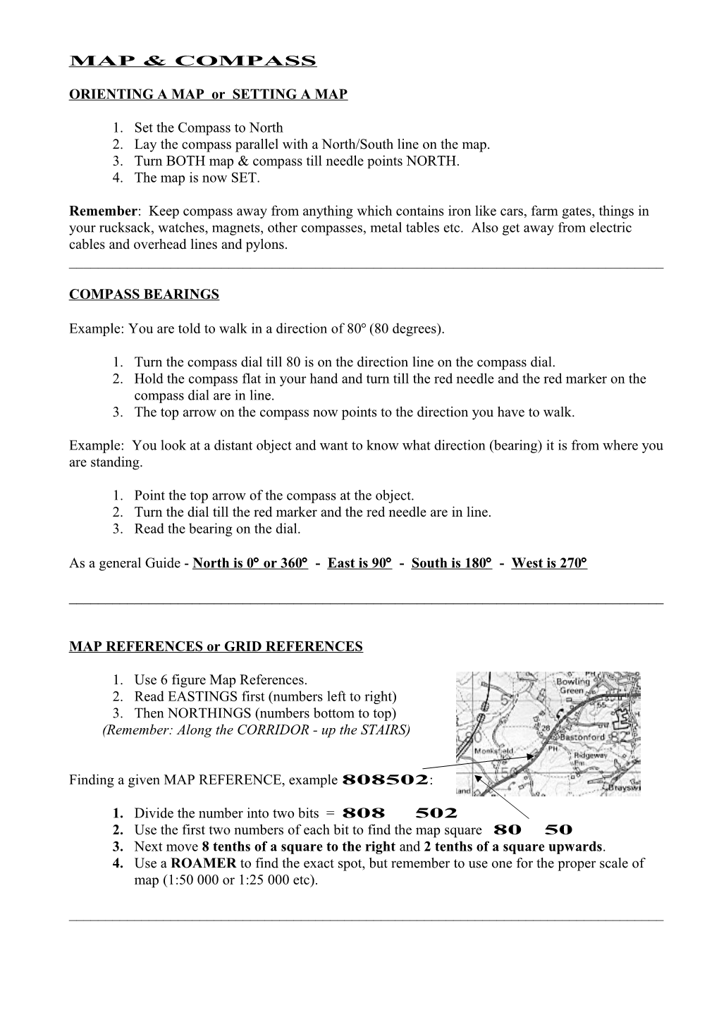
MAP REFERENCES or GRID REFERENCES
- Use 6 figure Map References.
- Read EASTINGS first (numbers left to right)
- Then NORTHINGS (numbers bottom to top)
(Remember: Along the CORRIDOR - up the STAIRS)
Finding a given MAP REFERENCE, example 808502:
- Divide the number into two bits = 808 502
- Use the first two numbers of each bit to find the map square 80 50
- Next move 8 tenths of a square to the right and 2 tenths of a square upwards.
- Use a ROAMER to find the exact spot, but remember to use one for the proper scale of map (1:50 000 or 1:25 000 etc).
______
ROUTE CARDS - PLANNING A HIKE
Route cards have two main purposes.
- Work out your route before you hike to find the time it will take, places to rest, how difficult or easy it is.
- Safety - you leave copy of a route card at base (or home) with contact names in case you are late back or something happens on the way. Rescuers can easily follow your route.
Details required on ROUTE CARD:
- Names of everyone on the hike.
- A Home Contact name and telephone number.
- Starting point (Map reference and description) and date & time you started.
- Main stages on the hike (Map references and description of the route.)
- Time each stage will take.
- Distances to walk and also height gained or lost. (Uphill or downhill)
- Date, time and place (Map reference) you expect to finish.
NAISMITH'S LAW -It takes an average 20 minutes to walk 1 kilometre.
But add 1minute for every 10-metre height climbed.
DO NOT subtract time for going downhill!
Hint: On 1:50,000 scale maps every 2 Centimetre square is 1Kilometre.
Brown Contour Lines are in Metres above Sea Level and are rise every 10 metres.